Pilu and Yangtou Trail - One Day
- Wowool小編

- Jun 25, 2023
- 3 min read
Mt. Pilu 3317m
Mt. Yangtou 3035m
Our plan is to commence the expedition from Bilu Mountain, traverse through Ju Mountain, reach Yangtou Mountain, and subsequently descend to the entrance of Yangtou Mountain to conclude the day's journey.

Date of trail
(Garmin Fenix 7S solar+All trails):
Summit Mark:3317m(Pili)、3035m(Yangtou)
Length:23.3km
Elevation gain:1759m
Time:13 hr 16m (including breaks)
Temperature:7~20°C
Tema Members:5 people
Water:water1200c.c.+soft drink800c.c
Note: The data provided is for reference only. Readers should assess their own abilities and formulate a mountaineering plan before proceeding.
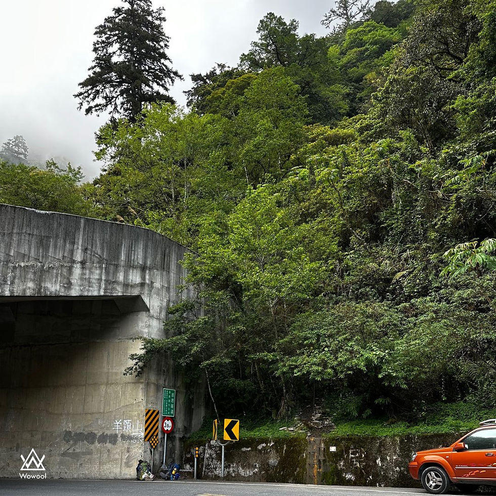
Due to construction restrictions on the Taroko Gorge section of Provincial Highway 8, there are only five designated time slots for passage each day. Therefore, it is crucial to manage the schedule effectively, taking into account contingencies for team members' conditions. Otherwise, it may be necessary to seek accommodation in Hualien.
It is recommended to visit the Taroko National Park website for information before departure.Click here
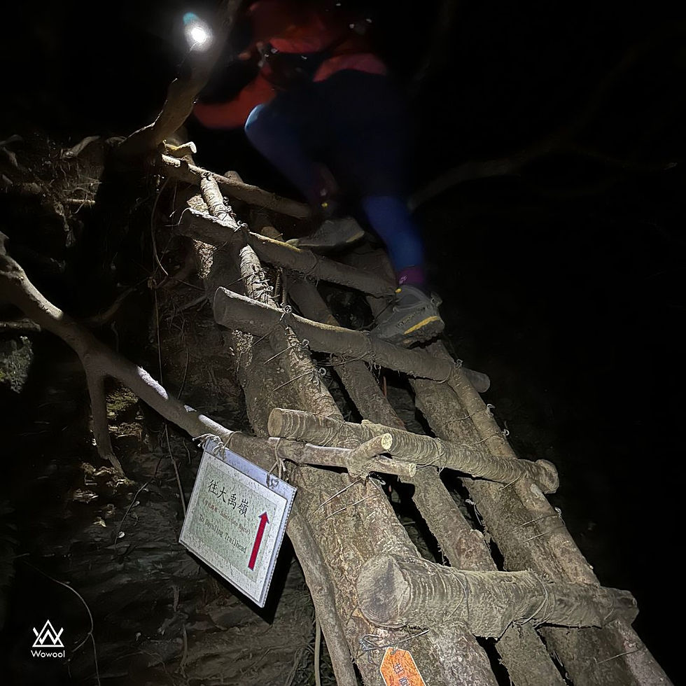
Since the drive from Changhua to Dayuling took approximately 3 hours, we departed from Changhua at 11:00 pm and did not search for accommodation near the trailhead. Our team started the hike from the trailhead at 02:38, opting for a slightly longer route for safety reasons.
Many people choose to traverse the collapsed section of the 820 forest road on foot, but the soil and rocks above are extremely unstable, with the risk of collapse at any moment. It is strongly advised to allocate more time and take an alternative route to avoid this hazardous area.
The take-off temperature is around 7 °C. At this temperature, my wearing:
<Top>
Jacket:Montbellレインダンサー ジャケット
Fleece:クリマプラス100 ジップベスト Women's
Base Layer:Wowool Women's Long Sleeve Top 100% Merino Wool 180
<Bottom>
Tight:Montbellサポーテックニーロングタイツ
Pant:Uniqlo sport pant
Shoes:La sportiva tx5
The safe route includes an uphill stretch, so after climbing it, you quickly heat up and can stow away your jacket. Since Forest Road 820 is over eight kilometers long and it gets cooler during the night, it is recommended to wear a fleece until dawn.
If it rained a few days ago on Forest Road 820, there will be plenty of puddles on the road, and during the rainy season, you might even come across several waterfalls. You gotta watch your step when walking through those sections. The round-trip in a single day can be quite tiring. Walking on the flat Forest Road 820 in the early morning, it's easy to find yourself nodding off, so make sure to assess your physical stamina before heading out.
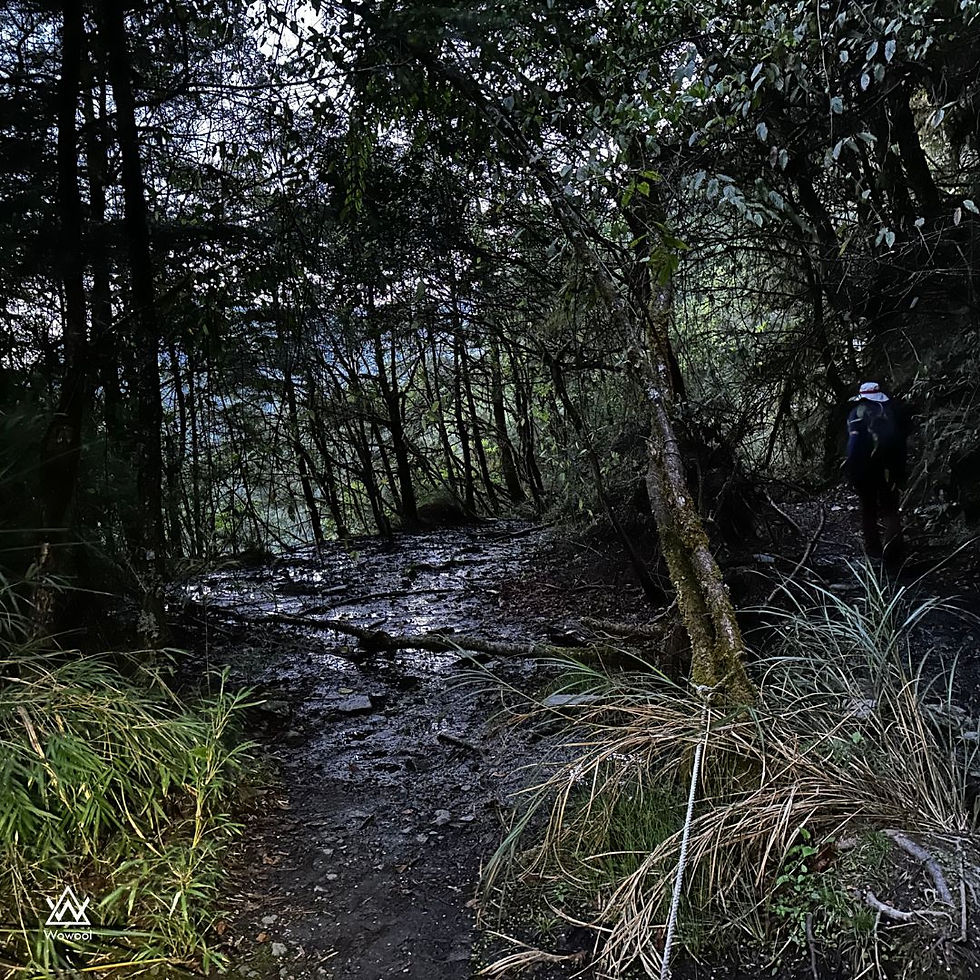
When arriving at the end of the 820 forest road, it means that there will be a 2-kilometer climb.
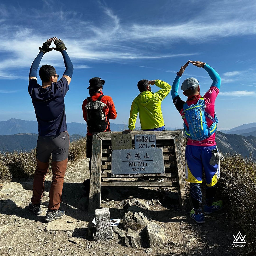
We arrived at the top of Bilu Mountain at 08:30. By that time, we had already covered a distance of 12.44 km. We couldn't help but wonder: Do we still want to proceed to Yangtou Mountain?
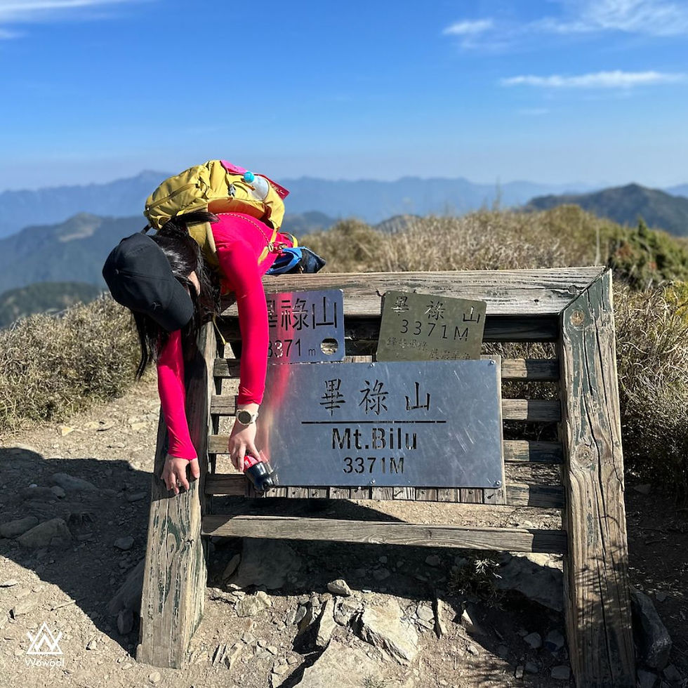
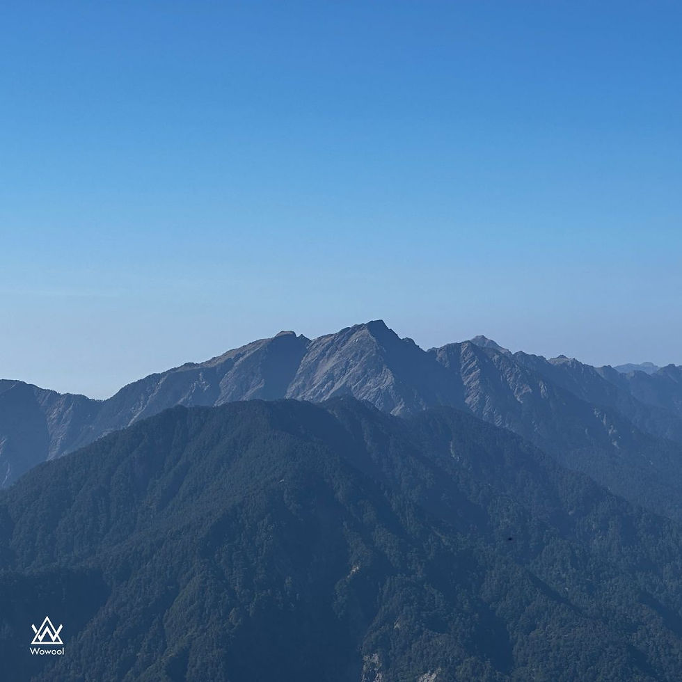
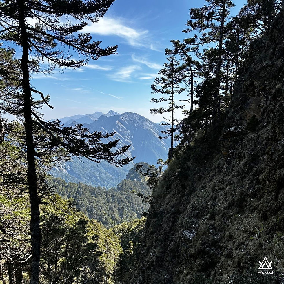
The weather was exceptionally clear that day, providing us with a stunning view from the top of Bilu Mountain.
From there, we could gaze upon the majestic Holy Ridge, Hehuan Mountains, Qilai Mountain and Qilai North Mountain, as well as Pingfeng Mountain.
After a complete rest until 8:50, we embarked on our journey towards Yangtou Mountain. The initial challenge was the 3.8 km stretch of ascending and descending terrain known as the Sawtooth Trail.
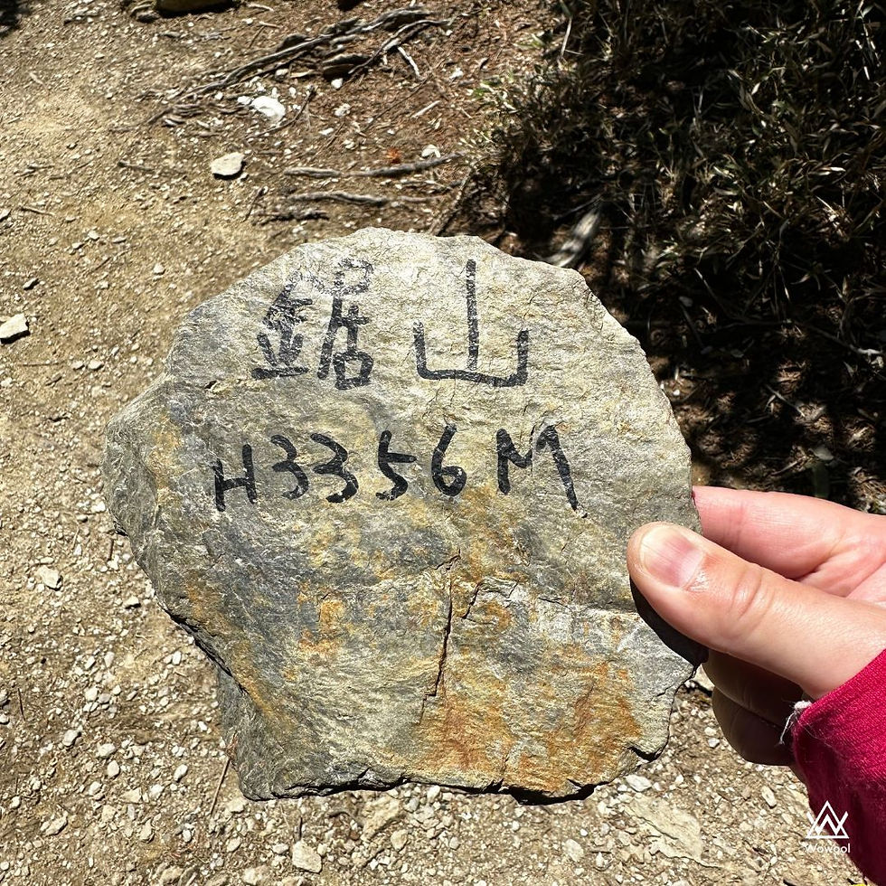
Along the way, I came across Ju Mountain and Ju East Mountain Cabin. I had anticipated Ju Mountain to be a considerable distance away, but to my surprise, I encountered a signpost on the second mountain.
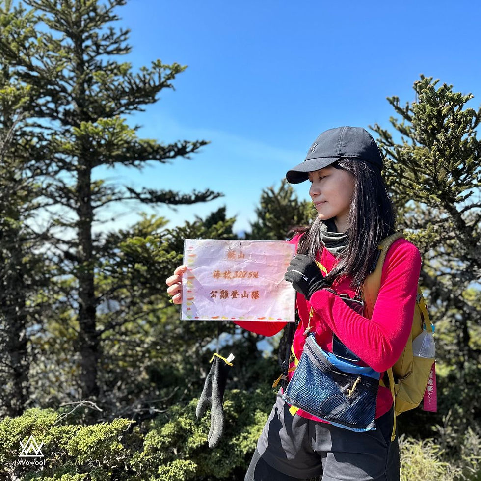
As we continued our journey and traversed several hills, we stumbled upon another stone marker that indicated Ju Mountain. This left us uncertain as to which of the markers was the accurate one.
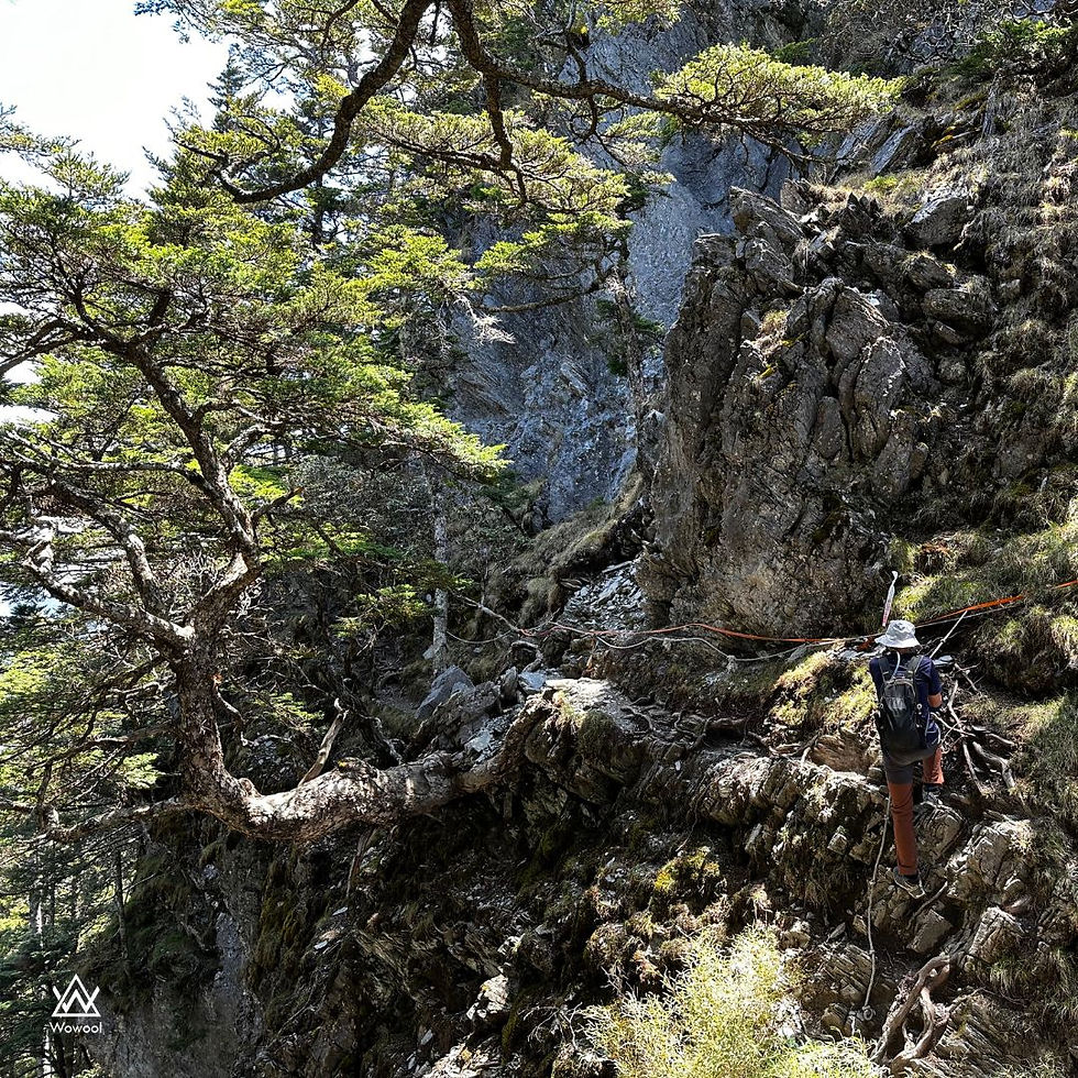
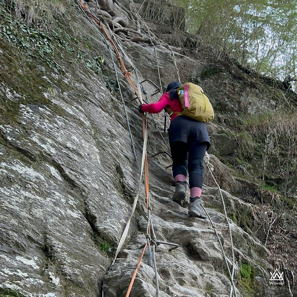
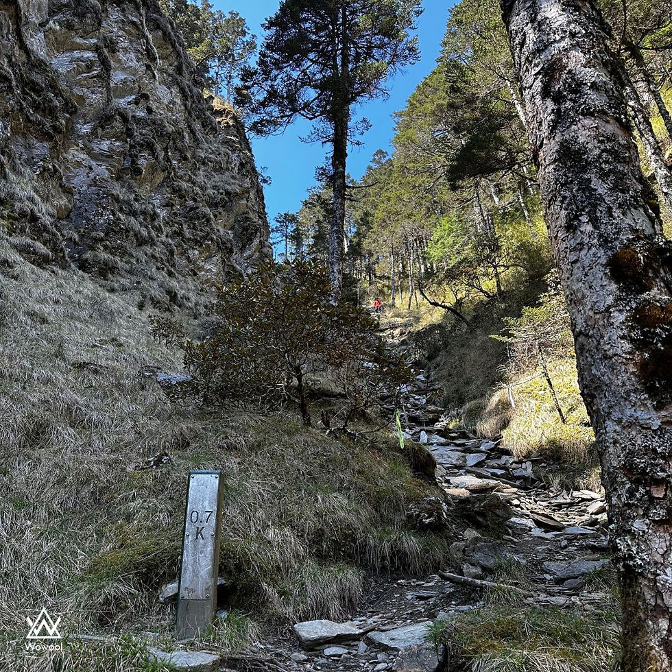
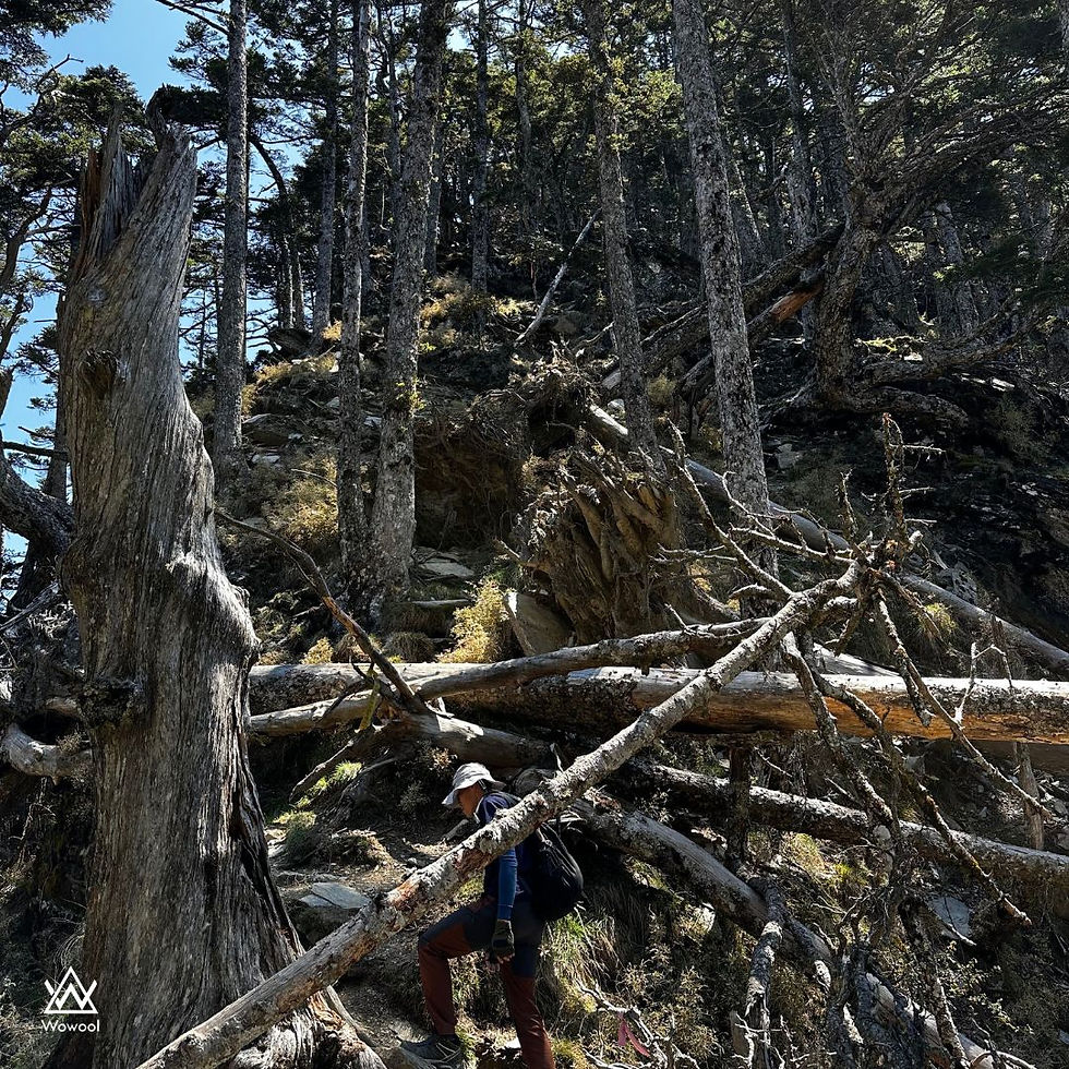
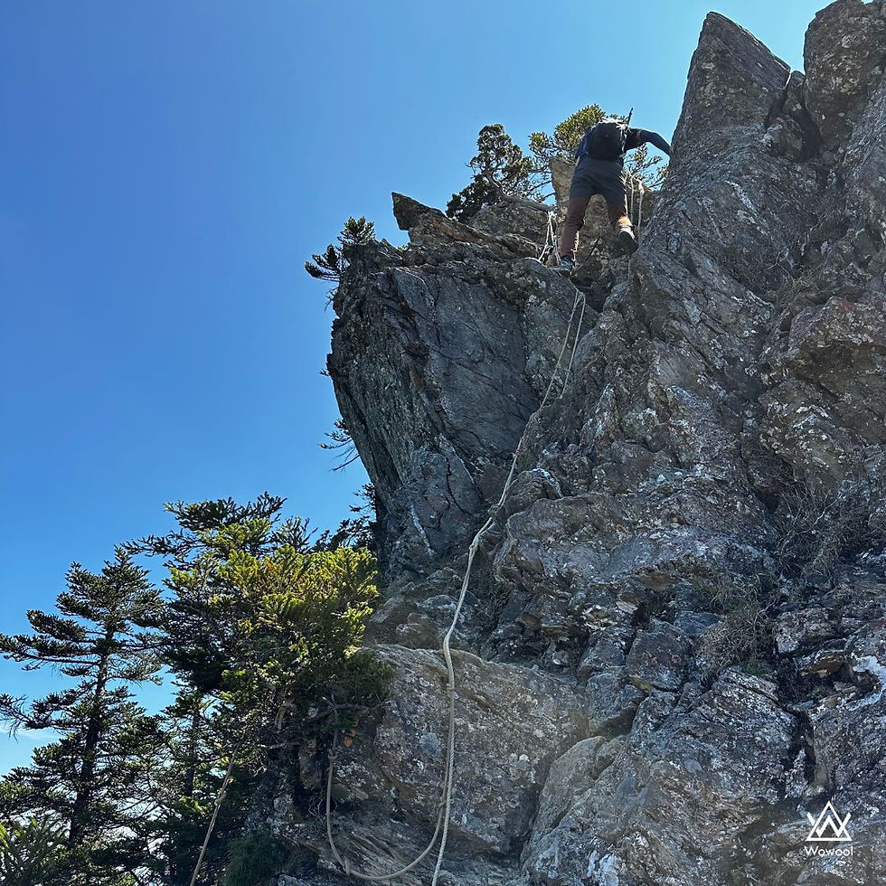
The Sawtooth trail, despite being only 3.8 km long, presented us with a diverse and challenging terrain, featuring steep slopes, vertical ropes, and fallen trees.
However, the beautiful sunlight of that day made every photo we took appear stunningly picturesque.
The arrow bamboo forest is indeed enchanting, creating a dreamy atmosphere as we pass through it.
After finally reaching Ju Dongshan Cabin, I realized that we were nearing a crucial fork in the road.

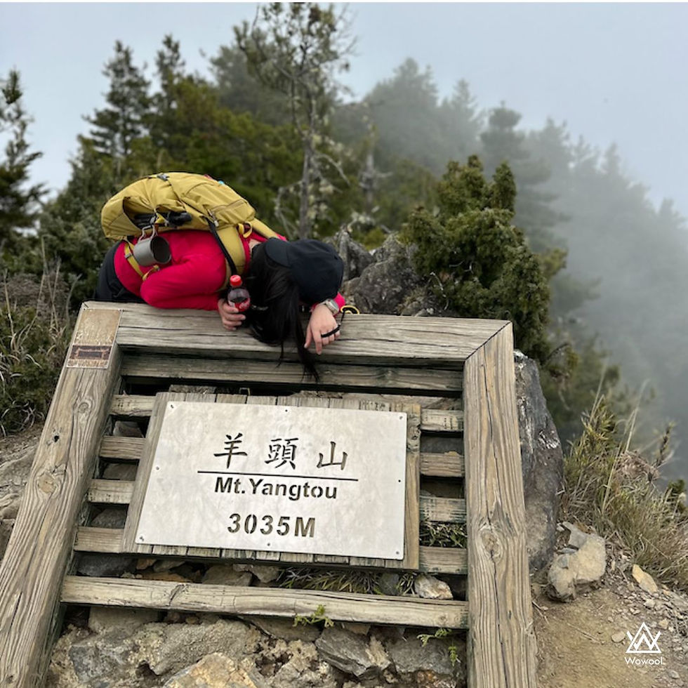
At 12:15, after reaching the Biyang fork, we continued walking for another 1.1 kilometers to reach the summit of Yangtou Mountain. By this time, the weather had started to become increasingly cloudy, but we pushed ahead with determination.
At 12:59, only two of us managed to reach the summit of Yangtou Mountain. Unfortunately, the other two individuals were not feeling well, so one person stayed with them while they descended the mountain to wait.
At 13:04, we began our return journey, walking 4.1 km downhill and then ascending back to the entrance of Yangtou Mountain. 15:55 Congratulations on reaching the final destination and completing the journey! Well done!
Due to the tight schedule, it is important for readers to carefully assess their own abilities before embarking on this trail.

Comments